| |
Abandoned Rails
Fall of the N&W Color
Position Light Signals
NS
Winston-Salem District
|
This
125-mile ex-Norfolk & Western (N&W) line extends
south from Roanoke, Virginia to Winston-Salem, North
Carolina. What gives the line its nickname are the
hundreds of curves, many in excess of 10-degrees,
and plentiful grades. The track elevation chart
resembles a roller coaster with north and southbound
ruling grades of
1.65%
and
1.56% respectively.
All of these factors contribute to the line's nickname: The Punkin Vine.
Norfolk Southern also utilizes the stiff southbound
grade on Starkey Hill to conduct adhesion testing of
new and experimental locomotives.
While the route is not truly abandoned as others
featured in the section of the website, it has lost
a major segment of infrastructure. Until
recently, the true gems of the Punkin Vine resided
along the northernmost 60-miles of the line: N&W
color position light (CPL) intermediate signals. While CPL
signals are still commonplace at many interlockings
throughout former N&W territory, the intermediate
signals have been gone for a decade or more on most
lines.
Due to the Pennsylvania Railroad's ownership stake
in the N&W, the company began utilizing position
light signals in the 1920's. The first
position light signals were installed on the
Shenandoah Division between Hagerstown and
Shenandoah in February 1924. In December 1926
the remaining segment of the line to Roanoke was
activated. In the early 1960's the
N&W removed the center light and changed the lights
around the outer perimeter to color bulbs, hence the
term color position light signal.
Unfortunately the
curtain fell on the Punkin Vine CPL signals in 2010 and
they are now just a memory. This page takes a
look back at many of the signals which dictated train
movement over this torturous route.
Appreciation is extended
to the following individuals for their
contributions: Joseph Norman, Kenneth Norman, Joe
Shaw, Ron Davis, Bill Whitbeck, and BJ Preddy.
Thank you!
If you have
any material you'd like to contribute, please
contact me at
jl.hawkins@comcast.net.
|
|
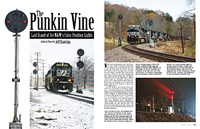 |
The Punkin Vine in
Print The
demise of the N&W signals along the
Winston-Salem District was the subject
of an article in the April 2010 issue of
Railroads Illustrated. You can
contact the magazine to order a back
copy by clicking
here. |
|
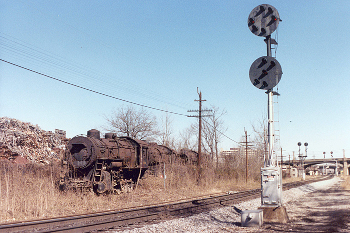
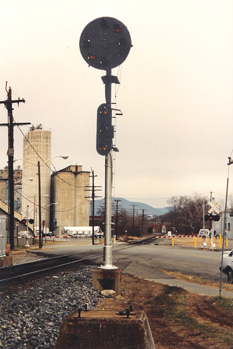
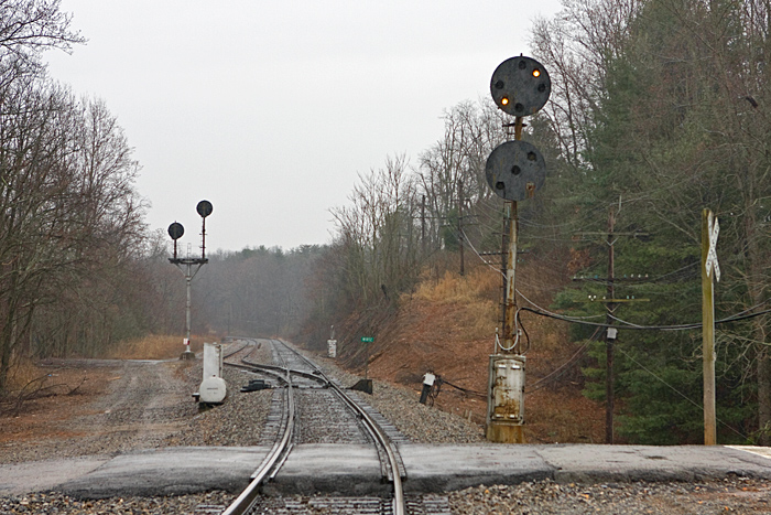
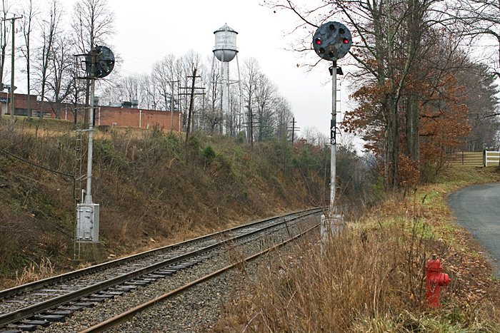
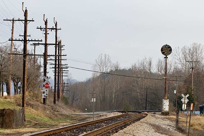
South JK (R1.3)
We are just south of JK in this view
looking north towards the diamond. This
interlocking was eliminated sometime between 1997
and 2002 in conjunction with the removal of the
double track on the Winston-Salem District through
Roanoke. Today there is just a Safetrans pole
signal at the diamond itself.
In the background is
N&W M2 Class No. 1118,
a 4-8-0 built in 1911 by Norfolk & Western at
their East End Shops in Roanoke. This engine
along with two sister locomotives were part of the
"Lost Engines of Roanoke" that resided here from
June 1950 until they were finally removed in August
2009.
Photo by Bill Whitbeck
(March 1986) |
|
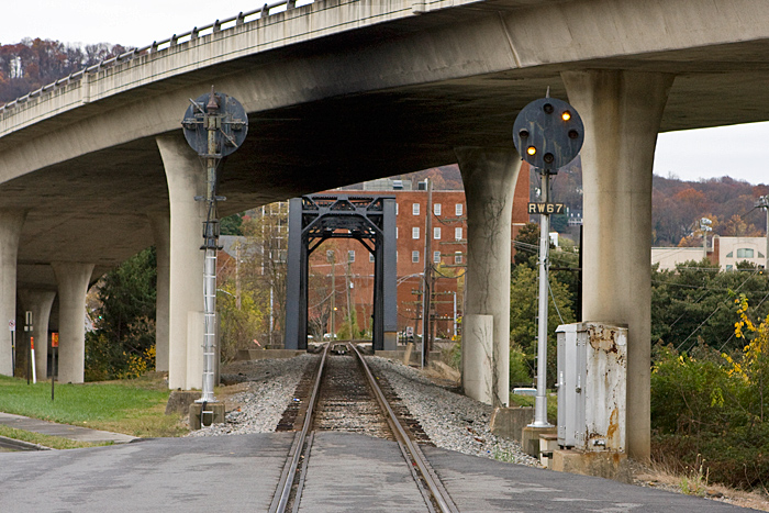
South Jefferson (R6.7)
Looking south from the Reserve Street
grade crossing with S. Jefferson Street on the bridge above.
Roanoke Memorial Hospital is out of view to the left
and directly ahead is the bridge over the Roanoke
River.
Photo by Jeff Hawkins
(November 13, 2009) |
|
South Jefferson (R6.7)
The northbound signal at South
Jefferson in 1991. Note the additional aspect
below the primary head. This was back when the
Winston-Salem District was still double-tracked
across the diamond at JK. Faintly visible in
the distance is the South JK signal (as seen at the
top of this page) designating the south end
of double track, hence the additional aspect.
In the background is Roanoke City Mills which was demolished in 2009.
Photo by Kenneth Norman (1991) |
|
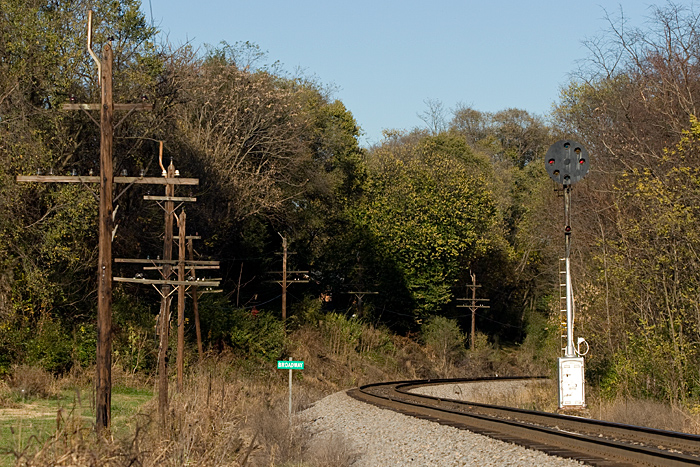
Broadway (R7.9)
This view is looking north adjacent
to Western Virginia Community College. The
southbound signal was just out of view around the
curve near the I-581 overpass.
Photo by Jeff Hawkins
(November 14, 2009) |

|
R9.0
Looking north from behind the Carmike
10 Cinemas at the Tanglewood Mall Shopping Center.
Photo by Jeff Hawkins (November
14, 2009) |
|
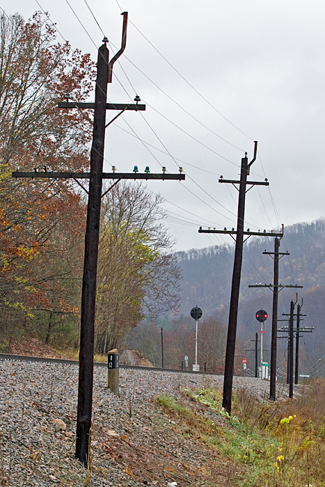
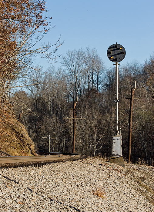
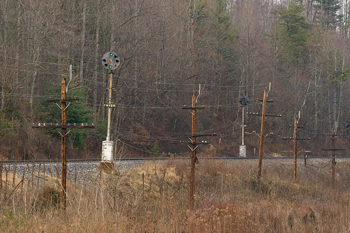
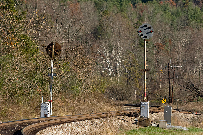
R11.2
These were the second set of
intermediate signals once located between Broadway
and Starkey. Today the Mennel Mill would
dominate this scene and can be seen under
construction in the left of this photo.
Photo by Ron Davis (January 2007) |
|
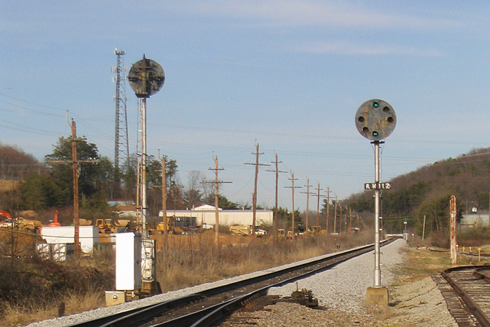
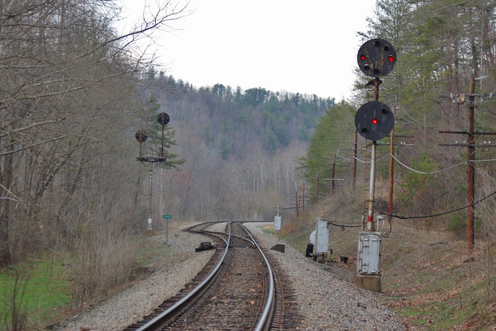
Starkey (R12.5)
Looking south along Merriman Road
with the R12 milepost visible in the foreground.
Photo by Jeff Hawkins (November
12, 2009) |
|
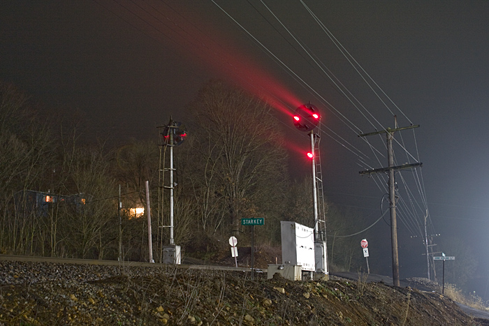
Starkey (R12.5)
This photo of the Starkey signals was
captured shortly before midnight on a mild winter
evening. The red beams of light cut through
the heavy mist which has settled in over the Roanoke
Valley.
Photo by Jeff Hawkins (December 26, 2008) |
|
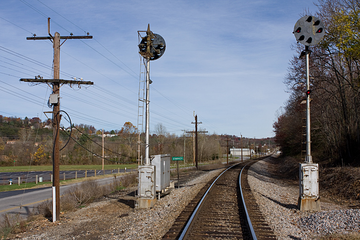
Starkey (R12.5)
Looking north from Annie Holland
Drive.
Photo by Jeff Hawkins (November
14, 2009) |
|
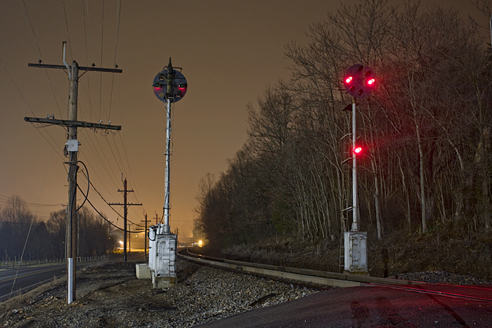
Starkey (R12.5)
Another view of the Starkey CPL
signals after dark.
Photo by Jeff Hawkins (December
26, 2008) |
|
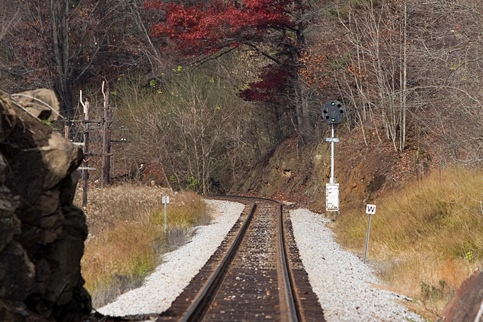
R17.4
Looking north at the northbound "Wright" signal.
This view was captured from underneath the US 220
overpass a few miles north of Boones Mill. The
tall code line poles lead me to believe that there
was once a grade crossing here.
Photo by Jeff Hawkins (December
27, 2008) |
|
R18.7
This block signal was easily visible
from US 220 which is just out of view to the right
down the hill. The photo is looking south from
Fisher Lane.
Photo by Jeff Hawkins (November
14, 2009)
|
|
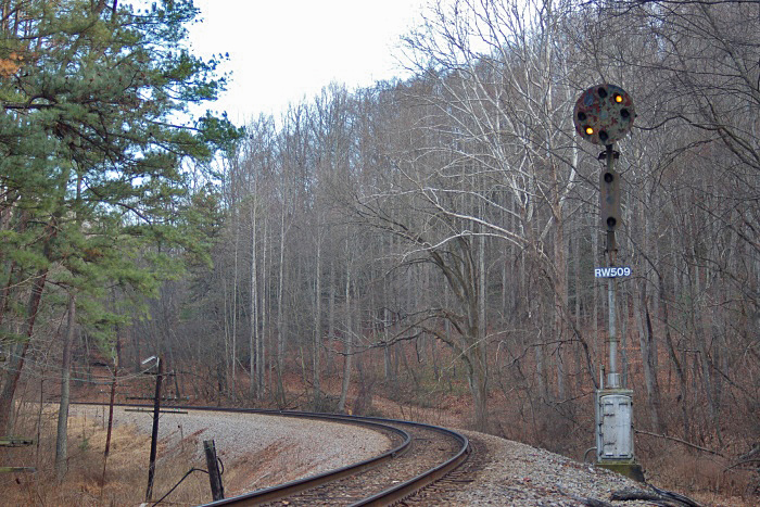
R19.0
Looking north from VA 624. This
signal was also easy to spot from US 220 which is
out of view to the left of the rock formation.
Photo by Jeff Hawkins (November
13, 2009) |
|
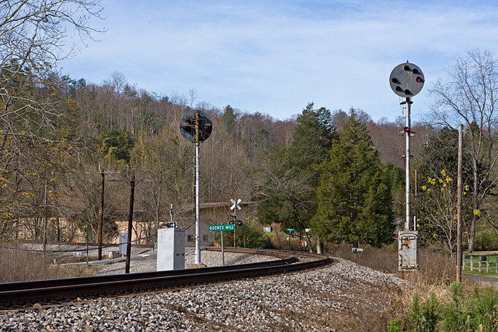
Boones Mill (R21.0)
These signals were located just south
of town near the intersection of Boones Mill Road
and Terrace Road.
Photo by Jeff Hawkins (November
14, 2009) |
|
R22.3
Photo by Jeff Hawkins
(December 26, 2008) |
|
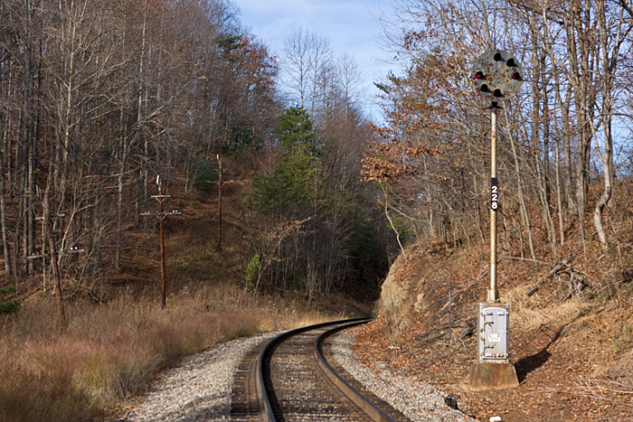
R22.8
Photo by Jeff Hawkins
(November 14, 2009) |
|
R24.1
Southbound distant signal
to Wirtz.
Photo by Jeff Hawkins
(November 14, 2009) |
|
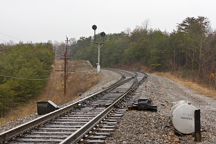
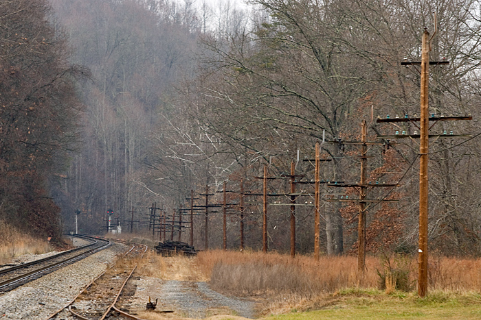
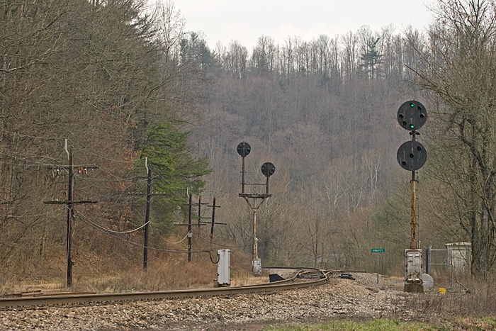
Wirtz (R25.5)
North end of 8,800'
siding. In the foreground is the
Rainbow Road grade crossing.
Photo by Jeff Hawkins
(December 26, 2008) |
|
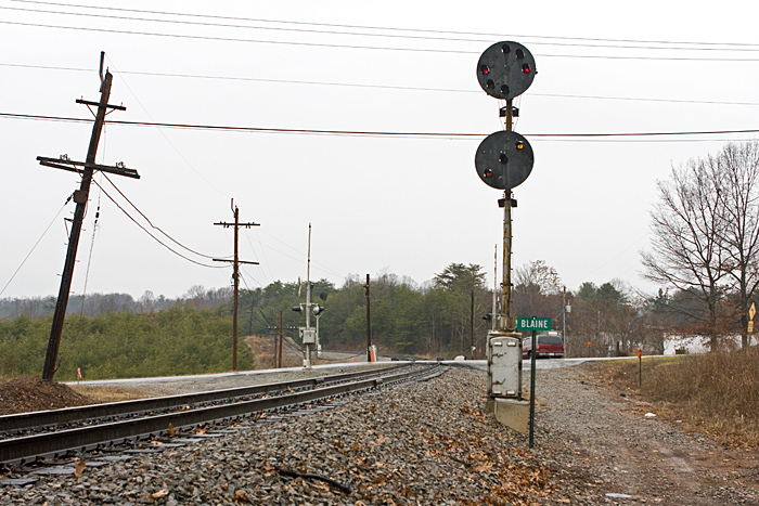
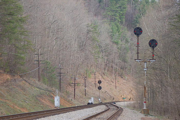
Blaine (R27.2)
South end of 8,800'
siding. Looking north from
Bonbrook Mill Road.
Photo by Jeff Hawkins
(December 26, 2008) |
|
Blaine (R27.2)
South end of 8,800'
siding. The Bonbrook Mill Road
grade crossing is in between the signals
at Blaine and can be seen in the
distance.
Photo by Jeff Hawkins
(December 26, 2008) |
|
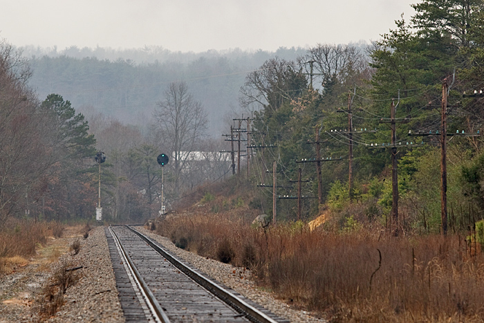
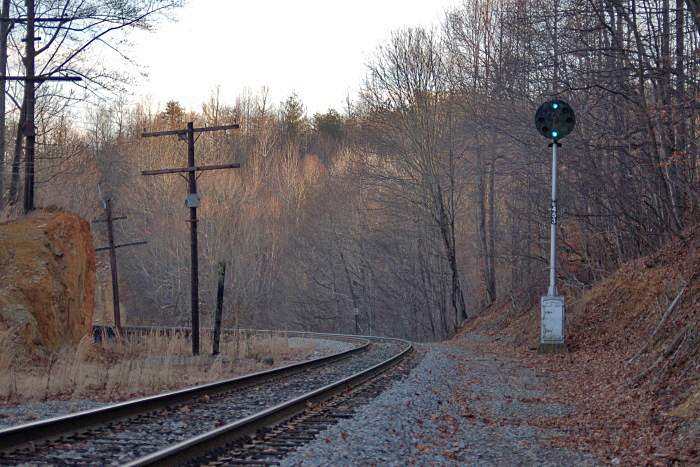
R34.5
As viewed looking south
from 6 Mile Post Road south of Rocky
Mount.
Photo by Jeff Hawkins
(December 26, 2008) |
|
R37.3
This signal was located
just south of the Old Forge Road
underpass.
Photo by Jeff Hawkins
(November 14, 2009) |
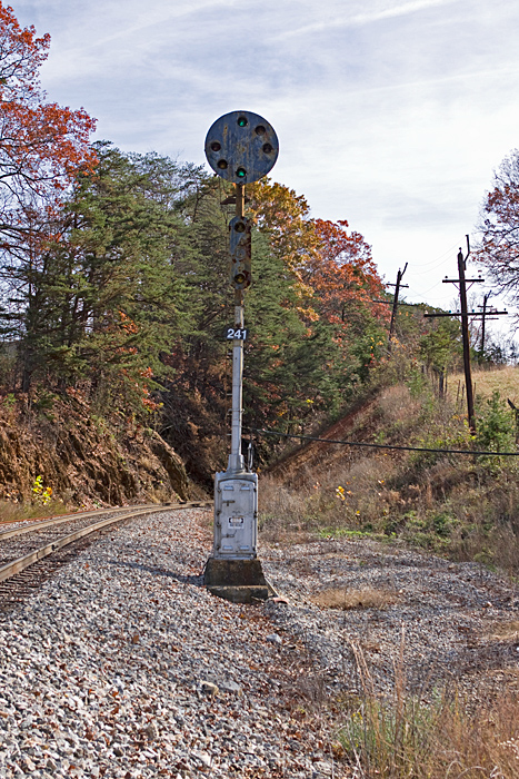
|
R38.0
Photo by Jeff Hawkins
(December 26, 2008) |
|
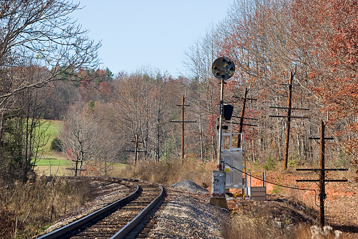
Ferrum (R41.9)
These signals were
positioned just south of the Fieldcrest
Road grade crossing in "downtown" Ferrum.
Timberline Road is visible to the right.
This was the crest of a 1.62% northbound
grade.
Photo by Jeff Hawkins
(December 26, 2008) |
|
R45.3
Photo by Joseph Norman
(January 2, 2008) |
|
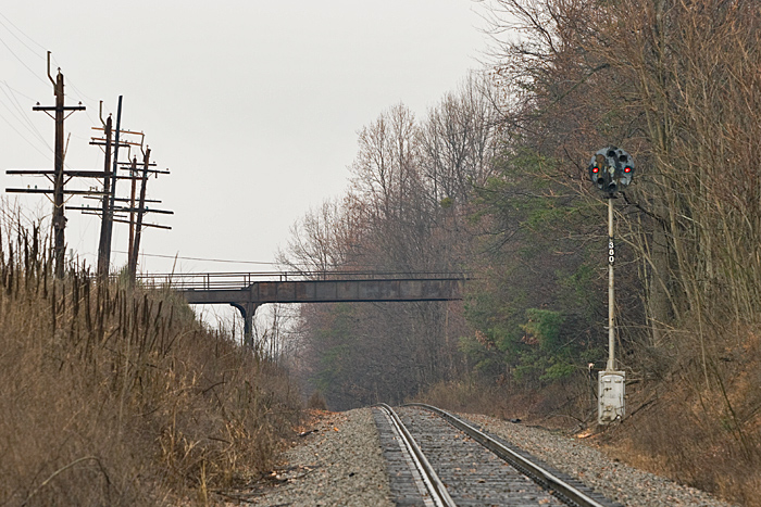
R46.8
The R46.7/8 intermediate
signals were located between Ferrum and
Henry adjacent to Prillaman Switch Road
which paralleled the tracks through this
spot.
Photo by Jeff Hawkins
(December 26, 2008) |
|
Henry (R48.2)
The view looking south
from Henry Road with the distinctive N&W
code line poles lining the right of way.
Photo by Jeff Hawkins
(December 26, 2008) |
|
R49.2
Just south of Henry were
these intermediate signals. This
was a great photo location with Henry
Road and Henry Fork Road offering easy
access to either side of the signals.
Photo by Jeff Hawkins
(November 14, 2009) |
|
R50.9
Southbound distant signal
to Philpott.
Photo by Joseph Norman
(January 2, 2008) |
|
Philpott (R53.0)
North end of a 9,209' siding.
This photo was taken from Philpott Drive and is
looking south towards Bassett.
Photo by Jeff Hawkins
(December 26, 2008) |
|
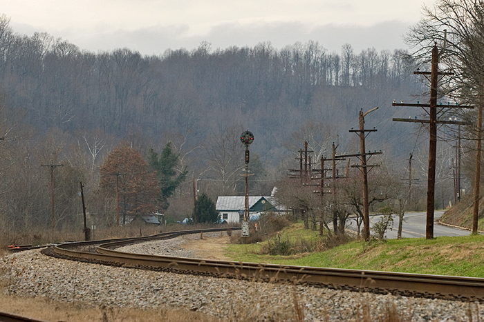
Jondee (R54.7)
Looking south at Jondee,
the south end of a 9,209' siding.
Photo by Joseph Norman
(March 24, 2007) |
|
Jondee (R54.7)
Looking north at Jondee,
the south end of a 9,209' siding.
Photo by Joseph Norman
(March 24, 2007) |
|
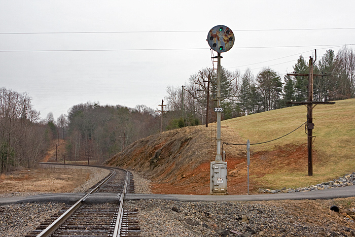
R56.9
This signal was located
in the Town of Bassett just south of the
former N&W passenger station.
Photo by Jeff Hawkins
(December 26, 2008) |
|
R57.0
This was the northbound distant
signal to Jondee also located in Bassett.
Photo by Jeff Hawkins
(December 26, 2008) |
|
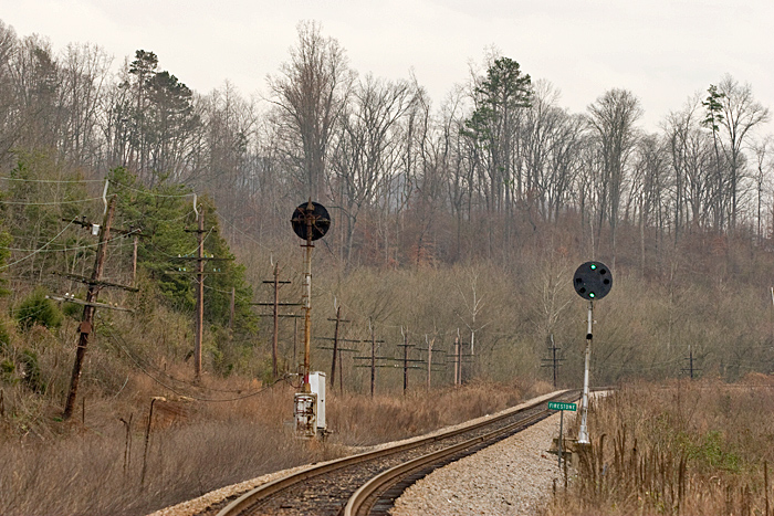
Firestone (R59.4)
A few miles north of Martinsville
were the "Firestone" signals. They were
located just south of where Edgewood Drive
paralleled the mainline near Stanleytown.
Photo by Jeff Hawkins
(December 26, 2008) |
|
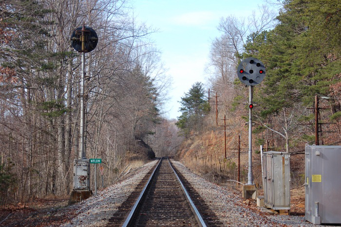
Nylon (R64.8)
Looking north from the
Nylon home signals that were located
several miles south of Martinsville.
Photo by Joseph Norman
(December 25, 2007) |
|
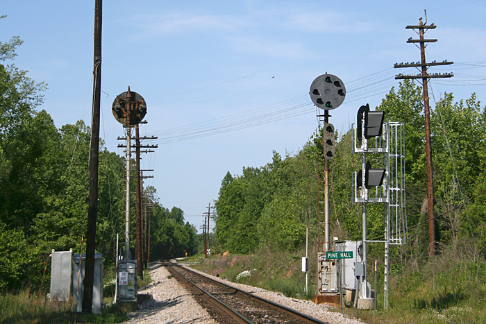
Pine Hall (R103.6)
The Pine Hall (NC) signals were located
just south of town. In this 2007 photo we are
looking south in between the two Brickyard Road
grade crossings.
Photo by Joe Shaw (2007) |
|
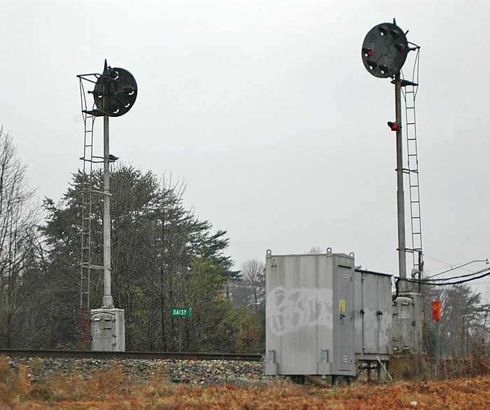
Daisy (R120.2)
The Daisy home signals were located
just south of the autoramp at Walkertown.
Photo by BJ Preddy (December 15, 2007) |
|
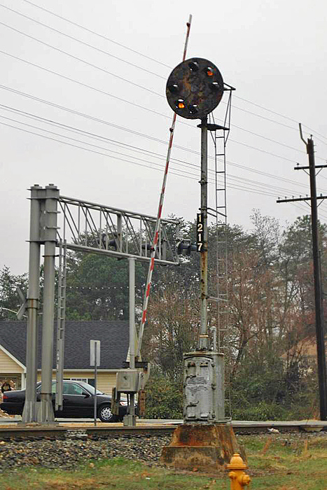
R121.7
This intermediate was located between
Walkertown and North Winston. This signal was
eliminated altogether when Safetrans were installed
on this portion of the line as a result of
lengthening the blocks.
Photo by BJ Preddy (December 15, 2007) |
|
|