Virginian Railway - Sewells
Point to Victoria
|
Most railfans and historians
recall the Virginian (VGN) as one of the major Appalachian coal haulers.
Two of my favorite segments of this railroad are the Sewells Point and
Jarratt Districts of the old Norfolk Division. As a result of the 1959
takeover by the Norfolk & Western (N&W), the Jarratt District quickly became a redundant,
parallel route with little business along the way. In time the line
from Algren to Abilene was abandoned and the track
removed with some of the rail not being dismantled until the early
1990's.
Between 2002 and 2008 I was
able to document various segments
of the remaining trackage and right-of-way that once comprised the
Sewells Point and Jarratt Districts.
Appreciation is also
extended to the other like-minded railfans and history buffs who have contributed photos
to this page. If you have images that you'd like to contribute,
please
e-mail me. |
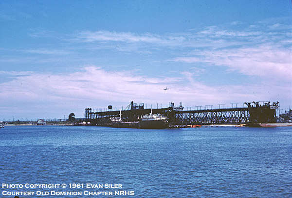
Sewell's Point
Sewell's Point was the
eastern terminus of the Virginian Railway and named after Henry Sewell.
There were two coal piers used to load the colliers. On the left
is Coal Pier No. 1 that was built in 1909 and completed for a cost of
$2.5 million. On the right is Coal Pierce No. 2, completed in 1925
and later upgraded in late 1950's. Both served the VGN faithfully
until it's 1959 merger with the N&W at which time coal loading
operations were transferred to the N&W's Lambert's Point facility.
The piers physically survived until 1966 when they were sold to the U.S.
Navy. Naval Station Norfolk currently occupies all of the land
that once comprised the piers, ground storage facility, engine terminal
and yard at Sewell's Point.
Photo by Evan Siler - June 1961
Quartermaster Junction - A5.8
This view is looking railroad east from Granby
Street in Norfolk towards Sewell's Point. Underneath the I-564 bridge
in the distance is
Quartermaster Junction. Here the track branches off and continues
compass west one mile to the Norfolk International Terminals. To continue
straight will take you on to West Junction and right onto the property
of Naval Station Norfolk where the Sewell's Point facility was located.
It was abandoned in the early 1970's when the US Navy wanted to expand
the runways on the airfield. Sewell's Point was also becoming more
of a storage yard as most activity occurred at nearby Lambert's Point.
I
doubt if I will ever attempt any photos on base due to post 9/11
security issues. This line was double-tracked during the Virginian era
from Sewell's Point to Carolina Junction.
Photo by Jeff Hawkins - March 15, 2003
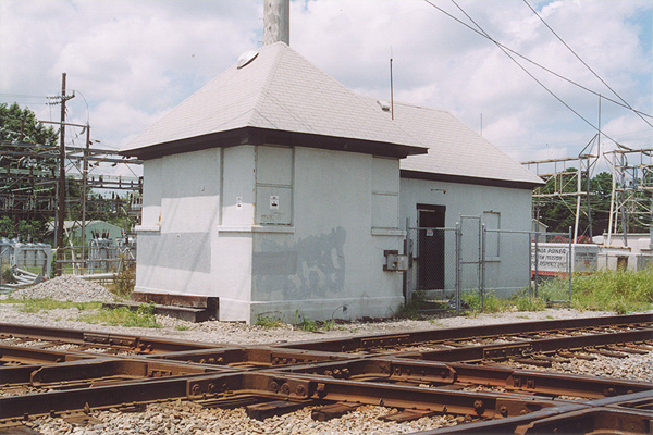
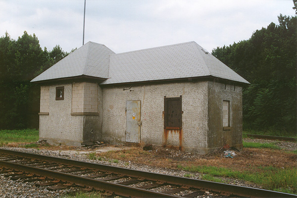
Coleman Place - A1.4
This "tower" is of typical Virginian architecture
and materials. It once guarded the diamond at Coleman Place where
the Norfolk Southern Railway crossed the Virginian in Norfolk.
Photo by Jeff Hawkins - February 15, 2003
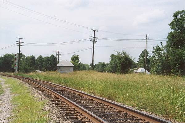
Carolina Junction - V4.5
The Norfolk Southern Railway and the Virginian crossed at grade
again at Carolina Junction in the City of Chesapeake. The diamond has long been
removed and connection tracks now allow movements through the immediate
area.
Photo by Jeff Hawkins - August 3, 2002
South Norfolk - V5.1
One of the major diamonds in the Tidewater area
was at South Norfolk. Here the Virginian crossed over the N&W's mainline
leading to Lambert's Point. During the Virginian era, this was a busy
location
with the two rival companies shuttling coal to the awaiting Colliers
in Hampton Roads. The Virginian mainline ran along the right edge of the photo between the two
poles in the right side of the photo. The track in the foreground is the connection track to the
N&W's Portlock Yard and existed as far back as the steam era. The diamond was eventually removed and two new
connection tracks were installed in the northeast and northwest
quadrants.
Photo by Jeff Hawkins - August 2, 2003
South Norfolk Tower - V5.1
The tower at South Norfolk controlled
train movements across the diamond with the N&W at the north end of
Portlock Yard. The Virginian mainline once ran just to the left of the
structure in this photo.
Photo by Jeff Hawkins - February 1, 2002
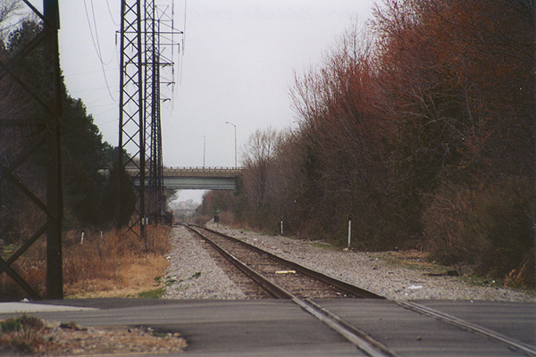
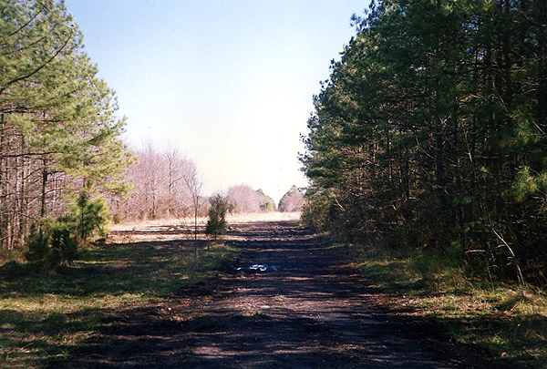
Chesapeake
Here we are looking west towards Suffolk from the
City of Chesapeake. This photo was taken at the Ramp Shop Road grade
crossing which is approximately one mile west of the South Branch Bridge
over the Elizabeth River. There is a cement plant just behind me and I
believe it's the westernmost business on the existing Jarratt
District trackage in Tidewater. I have not investigated the line any further to the west
through Chesapeake, but plan to do so in the future.
Photo by Jeff Hawkins - August 2, 2003
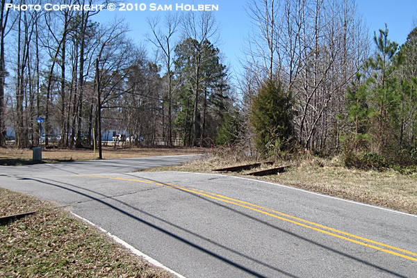
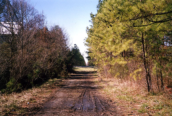
Sunray - Homestead Road
This view is looking south
on Homestead Road near Sunray toward it's intersection with Sondej Road.
The former VGN mainline is still easily identifiable.
Photo by Sam Holben - March 2010
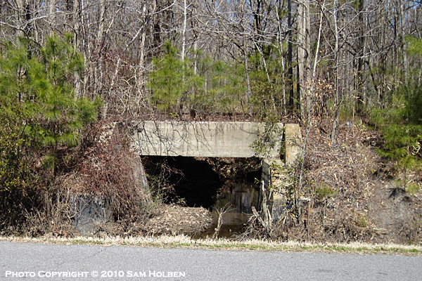
Algren
This small concrete bridge
is located about 2/3 of a mile west of the former crossing at Algren
along Sondej Avenue. If you look closely you'll see exposed rail
above the center of the structure.
Photo by Sam Holben - March 2010
Algren - V15.4
About halfway between Norfolk and Suffolk, the Virginian
crossed the Seaboard Air Line (SAL) at grade. This location was known as
Algren and is easily accessible from US 460. This photo is just east
of Algren looking south down Snowden Road where it intersects with Sondej Avenue. This old grade crossing is about 1,000 ft. east of where
the diamond was once located. One can only guess at what purpose the
concrete base to the left of the road served. It's on the wrong side of
the road for a crossing gate. Perhaps it served as the base for
the distant signal to the diamond?
Photo by Jeff Hawkins - August 2, 2003
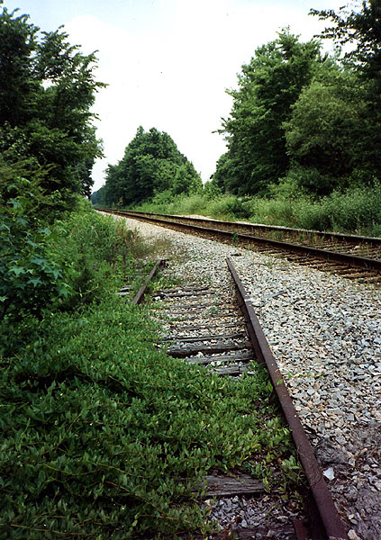
Algren - V15.4
Steve Hammer submitted this excellent view looking
east at Algren where the Virginian and the SAL crossed at grade. The last remnants of the Virginian
track are still visible in this 1992 photograph. The exact
location of the former crossing is about 400' east of where Bisco Street
crossed both mainlines.
Photo by Steve Hammer - July 1992
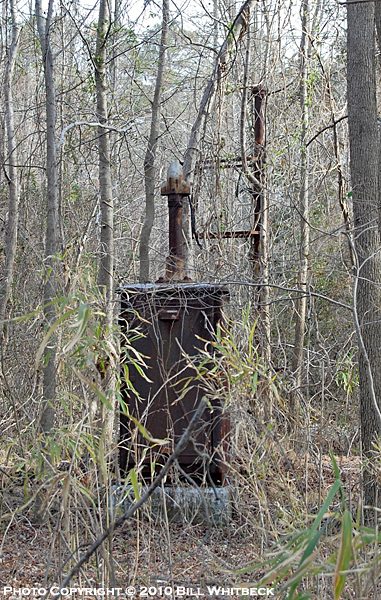
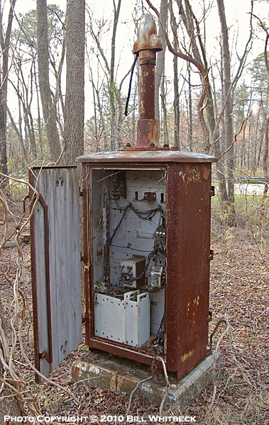
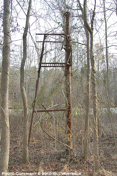
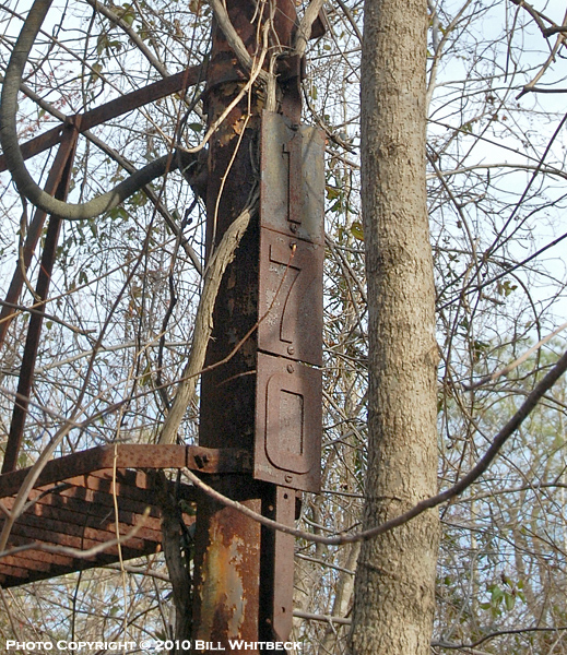
Algren - V17.0
The four proceeding
photographs show the remnants of the eastbound distant signal to the
diamond at Algren. As noted by the number plates in the above
photo, the signal was located at mile 17.0. In the third photo you
can see the former SAL mainline (now the CSX Portsmouth Subdivision)
which ran parallel to the Virginian between Algren and Suffolk.
Many thanks to Bill Whitbeck for braving the elements to capture these
images.
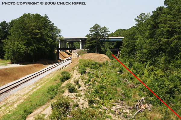
Kilby - V26.0
In this 2008 photo we are
looking west at Kilby, where the N&W's Norfolk to Roanoke mainline crossed over both the Seaboard Air
Line (SAL) and the Virginian. The red line to the right represents
where the VGN tracks once laid. The single track in the left
of the photo was the ex-SAL main between Norlina, NC and Portsmouth, VA.
This track is now CSX's Portsmouth Subdivision with the line being
abandoned from Garysburg, NC to Norlina. The N&W's bridge is
visible in the distance while the large concrete bridge carries US 13/58
around Suffolk on what is called the Northern Bypass.
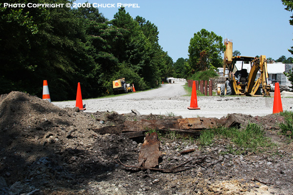
Kenyon - V27.7
We are on the west side of
Suffolk in this view looking west from the old Kenyon Road grade
crossing which is in the process of being removed.
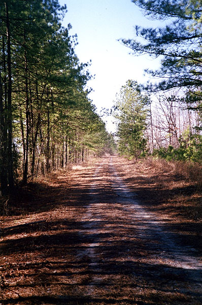
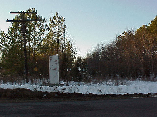
Sedley - V46.0
Looking east near Sedley.
Photo by Steve Hammer - December 1991
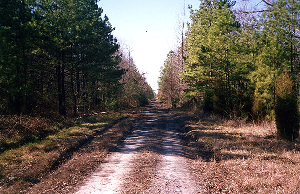
Sedley - V46.0
Another view from Sedley, this time looking west
towards Victoria.
Photo by Steve Hammer - December 1991
Sebrell
An eastward view from Sebrell.
Photo by Steve Hammer - December 1991
Sebrell
Looking west from Sebrell.
Photo by Steve Hammer - December 1991
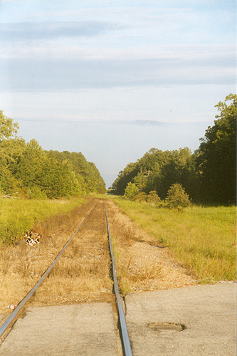
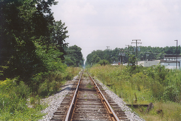
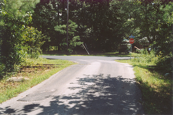
Jarratt - V73.3
In a view looking towards the east, we see
what is left of the Virginian in Jarratt. This short stretch of
track remains active as it is used by CSX to serve the Georgia Pacific wood chip plant on the
west end of town.
Just east of this spot there was once a diamond where the Virginian crossed
the Atlantic Coast Line's Richmond-Jacksonville double-track main at grade. Today the route is
CSX's North End Subdivision and sees on average 30+ trains per day. The
rise in the distance is Interstate 95.
Photo by Jeff Hawkins - September 2002
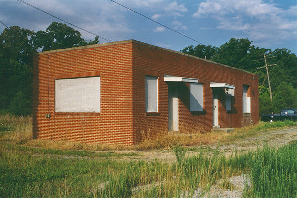
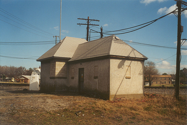
Jarratt Tower - V73.3
The tower at Jarratt was a modern structure by
Virginian standards. It is my understanding that after the structure
was built, it was never occupied. Just behind where I'm standing is the
CSX mainline. Note the old Virginian pole to the right of the building
still sporting three cross arms. Can you only picture this scene in the
late 1950's with a pair of Fairbanks-Morse Train Masters waiting to
cross the diamond while the ACL's Champion blows past with a
purple and silver E unit on the point?
Photo by Jeff Hawkins - July 2, 2001
Alberta - V98.0
Not much to be seen here. This view is looking
east towards Norfolk from Church St. in Alberta.
Photo by Jeff Hawkins - January 4, 2002
Alberta - V98.0
In this unique view, we are once again looking
east down the old roadbed. This is where the Virginian crossed over the
Seaboard Air Line (SAL) on a bridge. Both lines were abandoned in the
mid-1980's. It's hard to believe such high drama took place in a
location that looks like this. The Virginian and Seaboard Air Line had a joint station
located in the northwestern quadrant of the crossing. In the early
days, there was an elevator to aide passengers in reaching the platform
for Virginian trains. That station was later replaced by a
smaller, more humble structure which still stands, albeit buried in a
thicket of pine trees. You can learn more about the abandoned
Seaboard Air Line through Alberta
here.
Photo by Jeff Hawkins - April 2002
Alberta - V98.0
Here we are standing in "downtown" Alberta on Main
St. looking west and can get a true sense of where the tracks once ran.
The electrical box and code line pole are long forgotten infrastructure
from a truly magnificent operation.
Photo by Jeff Hawkins - January 4, 2002
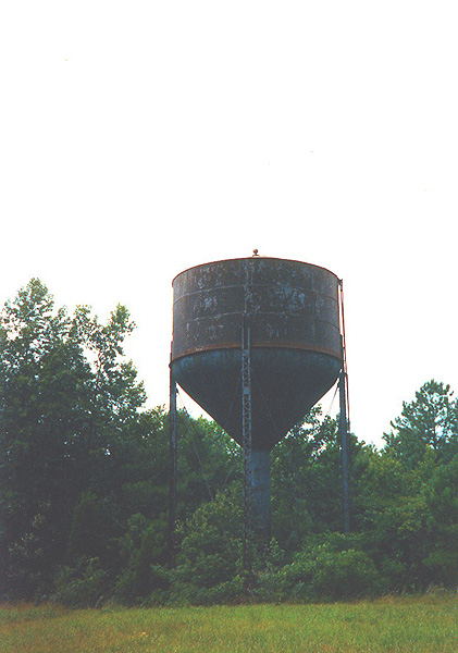
Alberta Water Tower - V98.0
The old water tower that
served the Virginian in Alberta.
Photo by Steve Hammer - July 1992
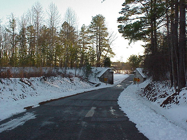
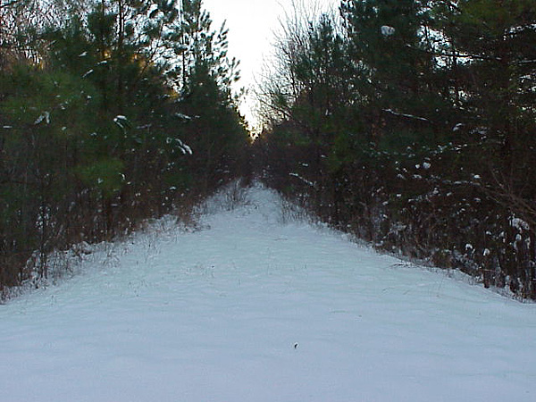
Danieltown - V104.0
While driving down Route 137
I happened upon this old underpass near Danieltown. The old roadbed can easily
be made out thanks to the recent snowfall. The concrete abutments still
sported faded chevrons which were painted for the safety of
approaching motorists.
Photo by Jeff Hawkins - January 4, 2002
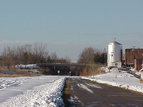
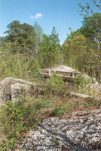
Victoria - V123.0
One of the more recognized locations on the
Virginian was Victoria. Fifty years ago I would have been standing in
the middle of the yard next to the passenger station. The silver water
tank to the right was once utilized by the railroad. The Route 49
overpass is referred to by locals simply as "the bridge". This view is
looking west towards Roanoke.
Photo by Jeff Hawkins - January 4, 2002

Victoria - V123.0
An eastward view from "the bridge" offers
this
overview of the site that the yard and shop complex once occupied. The roundhouse was
located in the wooded area on the right side of photo. Much of
this area is now a rail heritage park dedicated to the Virginian
Railway. The centerpiece of the park is Virginian C-10 caboose No.
342 which was placed on-site December 22, 2004.
Photo by Jeff Hawkins - May 17, 2003