Cima - Kelso
In the nineteen miles between Cima and Kelso, Ca. the railroad descends some 2,320 feet, at 2.2% ruling grade (the same grade as the north track in Cajon Pass). Speed is restricted to 35mph or less (depending upon the type of train and tonnage). The highway parallels the tracks which makes for some easy "chasing". You can get multiple shots of the same train at different locations while climbing or descending the grade. At times, there's also a lot of congestion here. Heavy westbounds stop at Cima to set retainers, other trains are held waiting for eastbounds to make the climb. The hotshots will often run around the slower trains here. There are four sidings between the two stations.
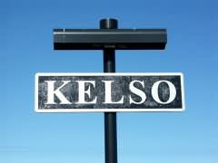
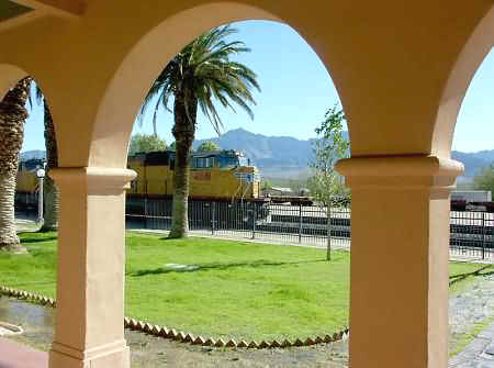
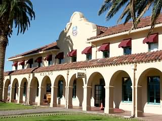
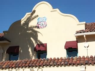
Kelso, Ca.
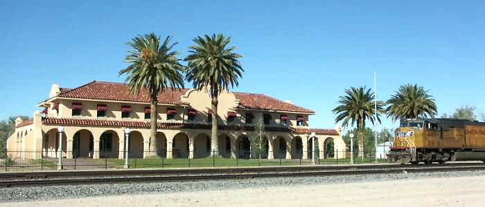
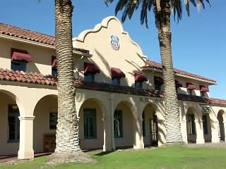
Kelso, at the bottom of the "hill," was born during the steam days. Helpers were added to almost every train here and a depot was built that contained a 24 hour beanery and rooms for the crews to rest. It was closed in 1985. The depot now belongs to the National Park Service and has recently been refurbished into the Mojave Preserve visitor center and museum. It is currently open to the public daily 9am - 5pm. There are exhibits, a reading room with railroad books and maps, gift shop, picnic tables and rest rooms. Definitely worth a visit if time permits. The lunch room is planned to reopen in the future.
|
|
4881 westbound |
 |
 |
 |
 |
This is a dangerous stretch of railroad. Over the years there have been a number of runaways and derailments. The most recent that I am aware of was in January, 1997 when the engineer on a westbound train descending the grade accidentally hit the multiple engine shut-down button, killing the diesels and losing dynamic braking. Despite putting the air brakes into emergency the train accelerated to 72mph before derailing 68 cars and tearing up a mile of track. For a narrative of this accident click here.
An even worse incident, involving a rear end collision and loss of life occurred in November, 1980. For a narrative click here.
 |
 |
 |
|
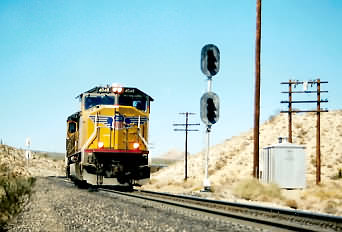
WB 4048 begins the descent at Cima |
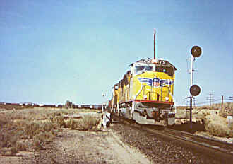
WB 4736 at West Elora |
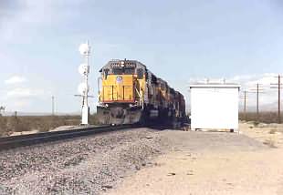
WB 6044 at CP237, East Kelso |
Getting there. Kelso is about ninety miles south of Las
Vegas. Exit Interstate 15 at the Nipton/Searchlight exit. After four miles, turn right on Ivanpah
road (there is a sign). Several miles further there is another right turn onto
Cima Road (there is another sign). There is a little store and post
office at the top of the hill at Cima but I suggest you bring your own drinking water - especially
during the hot weather. If you're adventurous, from Kelso it's 38 miles to
the BNSF (ex-Santa Fe) transcon. Take Kelbaker Rd (towards Amboy) 20 miles
to I-40 and continue on another 18 miles to National Trails Hwy (old Route 66).
Turn left (east) on National Trails Hwy, which follows the BNSF main
through Cadiz (where the Arizona & Calif. branch joins the BNSF), then Essex and
Goffs to Ibis (west of Needles), where you turn left (north) on US 95 for the return to
Las Vegas.